Point Cloud to BIM

3D Laser Scanning (LiDAR)

High-precision LiDAR scanning services that capture real-world environments into detailed digital point cloud data for accurate project planning.

Service Overview

Reality Capture with Millimeter-Level Accuracy

Advanced LiDAR technology is used to capture millions of data points from physical spaces, creating highly accurate digital representations of existing conditions. The process enables fast and reliable site documentation, making it easier to work on renovation, restoration, and construction projects with confidence and precision.

High-Speed Data Capture

Large and complex environments are scanned quickly while maintaining high accuracy.

Millimeter-Level Precision

Detailed point cloud data ensures highly reliable measurements for design and planning.

Versatile Project Applications

Supports as-built documentation, renovation work, and heritage site preservation.

3D Laser Scanning (LiDAR)

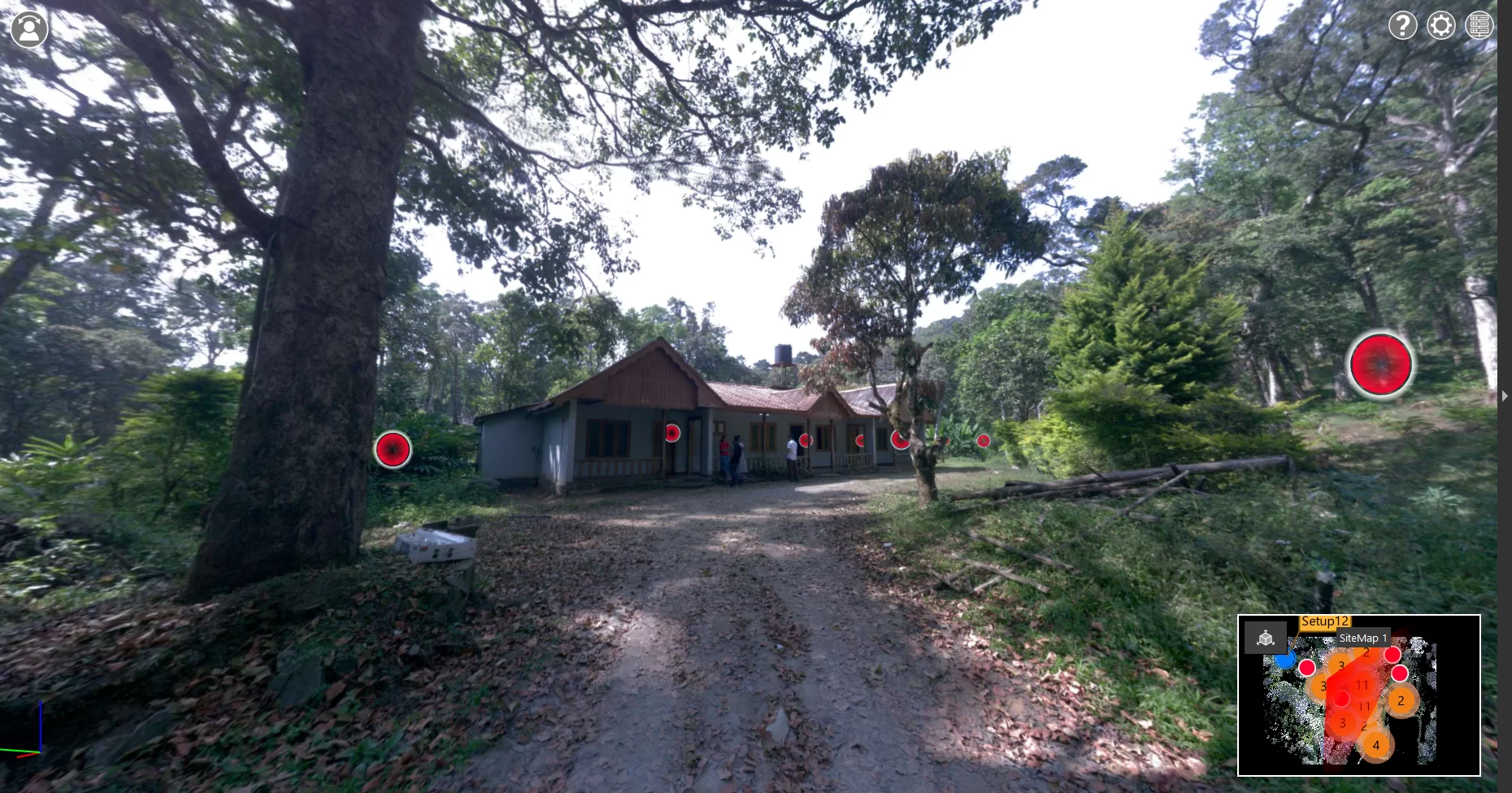
3D laser scanning (LiDAR) enables the accurate capture of real-world environments by recording millions of data points within a short time. This process generates highly detailed point clouds that represent existing site conditions with exceptional precision, capturing even complex geometries and hard-to-measure areas. By eliminating the need for manual measurements, it significantly reduces the risk of human error and ensures reliable data collection. At Dokteq, advanced scanning equipment and efficient workflows are used to capture site data quickly, often within a short time frame, while maintaining high levels of accuracy. The collected data is then carefully processed, aligned, and refined to produce clean, structured point clouds that are ready for immediate use.

The resulting data can be applied across a wide range of projects including renovations, heritage documentation, retrofit works, and large-scale developments. With fast turnaround and dependable accuracy, project teams can access precise site information without delays or repeated site visits. Dokteq ensures that all deliverables are compatible with major design and BIM platforms, making it easy to integrate the data into existing workflows. By converting physical spaces into reliable digital assets, the service supports better decision-making, improves coordination between teams, and helps streamline project execution from the early planning stages through to construction. 

Our Approach

Precision Reality Capture Workflow

Advanced scanning technology is used to capture site conditions quickly and convert them into accurate digital datasets.

Start Your Project
01

Site Scanning Execution

Laser scanners are used to capture the entire site, recording millions of spatial data points.

02

Point Cloud Generation

Captured data is processed into a structured and accurate point cloud representation.

03

Data Refinement & Alignment

Scans are cleaned and aligned to ensure consistency and usability.

04

Final Data Delivery

Processed point cloud files are delivered in formats ready for design and modeling use.

Architecture
Get Started

Ready to start your 3D Laser Scanning (LiDAR) project?

Let's discuss how our expertise can streamline your design process and ensure project success.

Contact Us